Premium Only Content

USGS Historical Topo Maps: Who Made Them
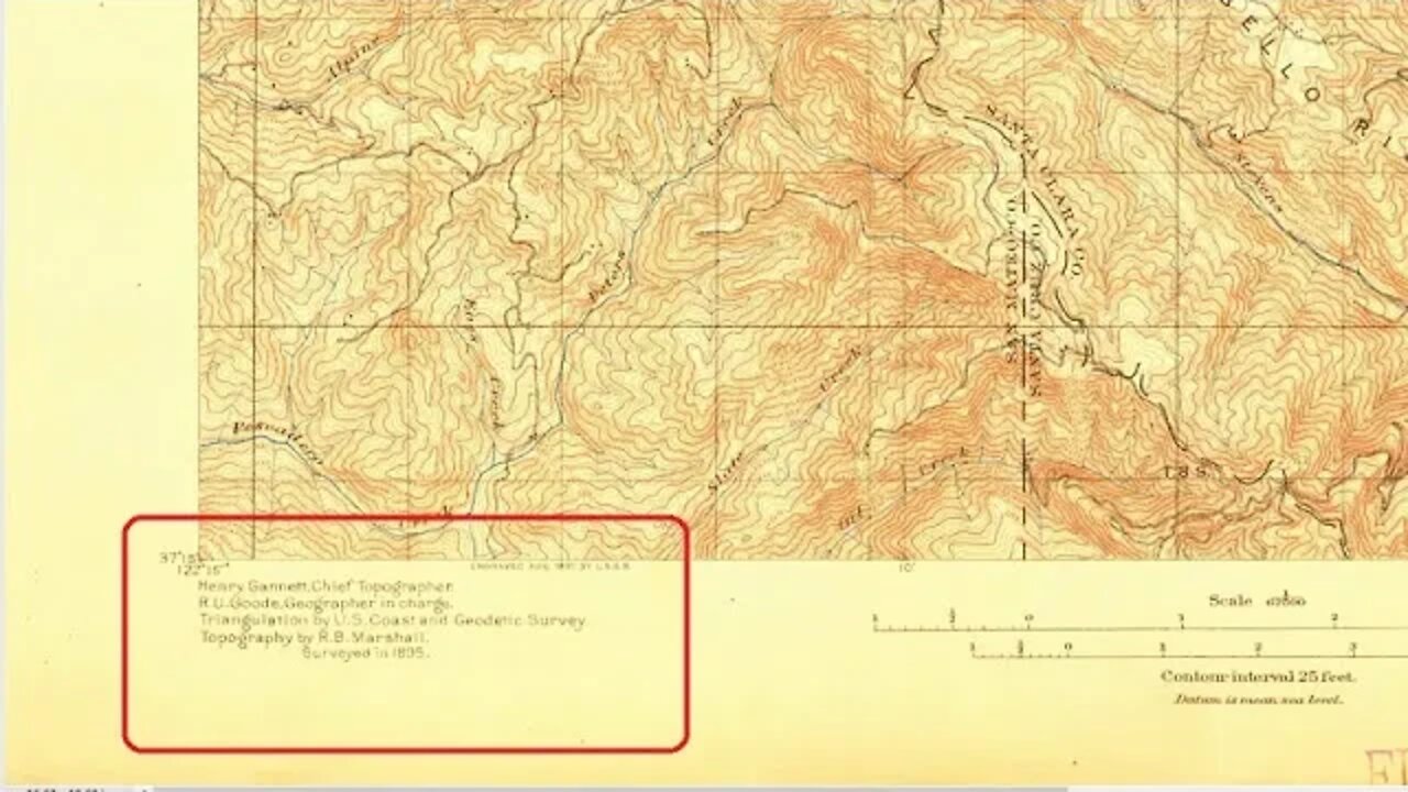
Doing a little research into the names listed on this old 1895 topographic map.
I see the same names on the San Jose map from the same year. Some names are different on the San Mateo and San Francisco maps from 1892 and 1899.
Avenza Maps:
https://www.avenzamaps.com/
You can have up to 3 user installed maps activated for off-line use in the free version if you want to try out a historic topo map.
TopoView web site to view/download maps:
https://ngmdb.usgs.gov/topoview/
USGS personnel:
Henry Gannett
https://www.thefamouspeople.com/profiles/henry-gannett-7484.php
Topographic Methods, 1906 publication:
https://pubs.usgs.gov/bul/0307/report.pdf
Richard U. Goode:
https://prabook.com/web/richard_urquhart.goode/1106515
Robert B. Marshall
https://www.watereducation.org/aquapedia/robert-b-marshall
https://pubs.usgs.gov/bul/0646/report.pdf
https://pubs.usgs.gov/bul/0673/report.pdf
https://oac.cdlib.org/findaid/ark:/13030/tf687005vn/
More to come...
Subscribe for more content like this
Comment, rate, share & click the bell icon
And as always, thanks for watching
-
 1:29:47
Real Coffee With Scott Adams
7 hours agoEpisode 2669 CWSA 11/24/24
67.6K27 -
 13:52
13:52
Hershberger's Kitchen
19 hours agoTwo Delicious Dip and Spread Recipes to Try, Inspirational Thought
55.4K5 -
 3:41:05
Sacred Sage
10 hours ago $4.16 earnedDaz3D: Attempting to Finish Zoe Conversation!
51.6K5 -
![[Stream #19 ] Gaming, Chatting, you know the drill!](https://1a-1791.com/video/s8/1/9/o/E/e/9oEeu.0kob-small-Stream-Sour-Pickle-100-Foll.jpg) LIVE
LIVE
OneRandomDolly
8 hours ago[Stream #19 ] Gaming, Chatting, you know the drill!
184 watching -
 11:07
11:07
TimcastIRL
1 day agoElon Musk Suggests He’ll BUY MSNBC, Joe Rogan Will REPLACE Rachel Maddow
85.5K101 -
 34:24
34:24
The Rubin Report
1 day agoFormer CEO: The Aftermath of Vice Media & What's Next for Mainstream Media | Shane Smith
93.9K41 -
 9:14:23
tacetmort3m
2 days ago🔴 LIVE - BECOMING THE UNTOUCHABLE (RADIATION WHO?) - STALKER 2 - PART 3
43K6 -
 16:05
16:05
China Uncensored
21 hours agoAnother Car-Ramming Strikes Outside a Chinese School!
33.2K13 -
 9:26
9:26
Dr. Nick Zyrowski
12 hours agoAnti Inflammatory Foods | You MUST Eat These!
25.3K6 -
 15:40
15:40
Bearing
8 hours agoEnd Stage Trump Derangement | Rosie O'Donnell is NOT Doing Well 😬
25.9K117