Premium Only Content

Grizzly Flat Trail, North/South Trail Junction, Closer Look
A return visit to the middle junction of the Grizzly Flat North and South trails. There's a short spur called the Grizzly Flat Cutoff Trail that joins the 2 trails here. Had more time this visit to spend exploring this area.
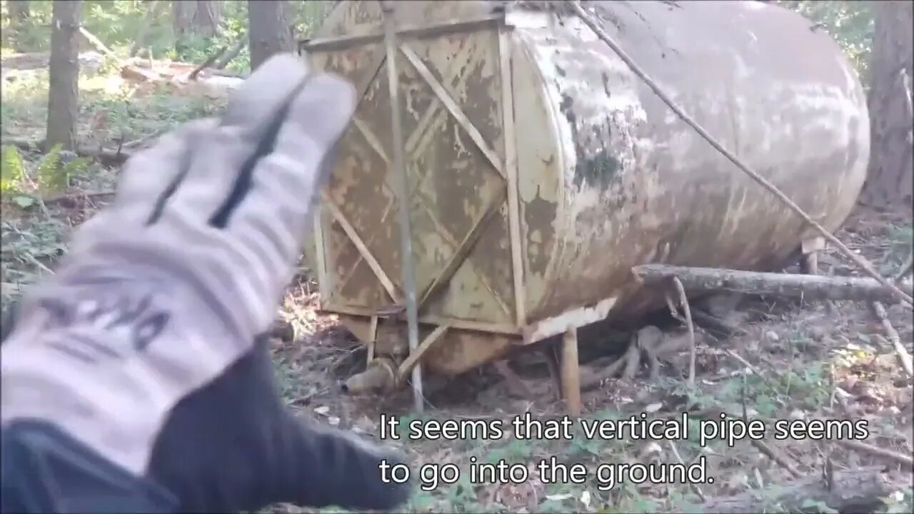
This is the only large, relatively flat area on this entire ridge. There's a large steel tank here, upon closer inspection, it appears to be around 5000 gallons. I wonder if that vertical pipe runs underground to a water source? Would need to use a metal detector to try and trace where it goes.
Looks like I've finally dialed in the DIY hill shade map calibration. Found the 2 "humps" or piles of dirt at the east end of this area along with the large ditch in the middle. This area has been leveled and a fair amount of earth moved both for that as well as the ditch.
What do you think this area was used for?
About the USGS hill shade maps:
https://apps.nationalmap.gov/viewer/
More to come, exploring off the the north east looking for signs of pipe and fencing and what looks like a faint trail...
Subscribe for more content like this
Comment, rate, share & click the bell icon
And as always, thanks for watching
#USGS #HillShade
-
 1:01:01
TheTapeLibrary
11 hours ago $1.03 earnedThe Horrifying True Story of Summerwind Mansion
9.57K2 -
 29:28
29:28
Afshin Rattansi's Going Underground
1 day agoMax Blumenthal on US’ Ukraine Aid Corruption, 'Psychotic' Israel Turning the West Bank into Gaza
22.1K1 -
 LIVE
LIVE
Flyover Conservatives
20 hours agoCovid, Control, & Corruption —Dr. Stella Immanuel’s Plan to BEAT the System! | FOC Show
385 watching -
 57:13
57:13
Sarah Westall
4 hours agoUnited States in a Two Front War, Identify Military Psyops and Special Operations w/ Jeffrey Prather
50.5K7 -
 2:14:05
Quite Frankly
7 hours ago"Open Phones: D.C. Crash, Senate Hearings, Petty Break-Ups" 1/31/25
37.3K9 -
 1:45:32
2 MIKES LIVE
7 hours ago2 MIKES LIVE #173 Open Mike Friday!
41.1K1 -
 54:53
54:53
LFA TV
10 hours agoDemocrats’ Greatest Fear Is Accountability | TRUMPET DAILY 1.31.25 7pm
31.1K15 -
 23:15
23:15
Bare Knuckle Fighting Championship
1 day agoBKFC FIGHT NIGHT MOHEGAN SUN FREE FIGHTS
29.5K2 -
 5:49:46
Bitfinex
10 hours agoBitfinex Talks Live at PlanB El Salvador - Day 2
31.9K2 -
 41:47
41:47
Candace Show Podcast
6 hours agoBecoming Brigitte: An Introduction
138K223