Premium Only Content

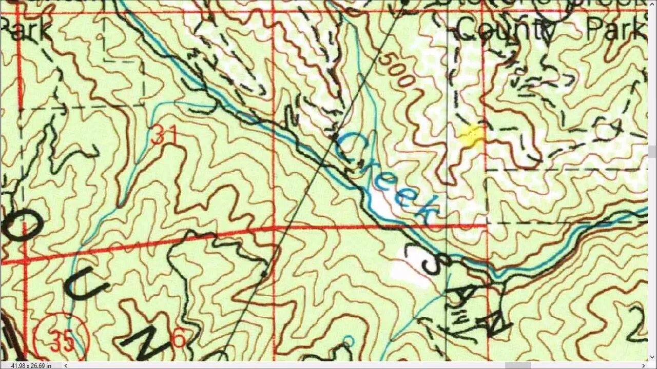
USGS Topo Maps: Changes Over Time
A deep dive into some tips and tricks I've found trying to make use of the USGS Historical Topo Maps as well as modern mapping/G apps while exploring Stevens Creek Canyon on on bicycle and on foot. Some might think a map is a map, who cares. If you think (Apple/Google/Bing/etc.) Maps is the be all and end all of maps, then you might want to skip this video.
From my experience, there's no "best" map or app for this kind of task. Rather there are many maps/apps all with pluses and minuses. They vary in what details they show, what time period they cover, and how they can be used out in the field with no data connection. In the end, you need to pull together bits and pieces from several maps/apps and then form a plan and go out and see what's actually out there. Then you may need to come back, gather up what you found and then maybe find something new out of another map and repeat the process.
I find this is a great way to get to know an area in depth. For years, I was riding up and down this road and it was just that part of the ride you had to grind through to get to the trails. But now, at every turn in the road, I can look over and see that there was an old structure there or an old road heading off here, etc. This is a great way to practice map reading, navigation, cross country hiking and G/app use. It's incredible when you can link up a historical map with modern G technology and see exactly where you are and navigate on that old map and look for roads and structures and then actually find them.
About the USGS HTMC:
https://www.usgs.gov/programs/national-geospatial-program/historical-topographic-maps-preserving-past
View/download maps on the TopoView site:
https://ngmdb.usgs.gov/topoview/
Subscribe for more content like this
Comment, rate, share & click the bell icon
And as always, thanks for watching
-
 LIVE
LIVE
Donald Trump Jr.
4 hours agoThe Left is Taking one L After Another, Live with Michael Knowles | Triggered Ep. 217
6,609 watching -
 47:17
47:17
Kimberly Guilfoyle
4 hours agoWoke Gets DOGE’d, Live with AJ Rice & Jarrett Stepman | Ep. 197
32.2K27 -
 20:11
20:11
Candace Show Podcast
2 hours agoBecoming Brigitte: Candace Owens x Xavier Poussard | Ep 6
81.6K195 -
 LIVE
LIVE
Dr Disrespect
7 hours ago🔴LIVE - DR DISRESPECT - ELDEN RING DLC - REVENGE
3,151 watching -
 1:01:52
In The Litter Box w/ Jewels & Catturd
1 day agoBest Presidents' Day Ever! | In the Litter Box w/ Jewels & Catturd – Ep. 743 – 2/17/2025
84K57 -
 1:29:15
Simply Bitcoin
7 hours ago $8.33 earnedThey JUST Triggered A Global Gold Rush: $1M Bitcoin is coming! | EP 1184
78.6K26 -
 1:50:47
The Quartering
7 hours agoElon Musk's 13th Baby, Trump Attends Daytona 500, and Ramaswamy Enters the Ohio Governor's Race
104K40 -
 1:28:04
Russell Brand
7 hours agoBREAKING: UK Troops To Ukraine | Zelensky Wants “Army Of Europe” | JD Vance SLAMS EU Tyranny – SF538
193K53 -
 1:46:20
Benny Johnson
8 hours agoPANIC: Feds FLEE DC After Mass PURGE, Fired USAID Activists EXPOSED | Trump DOMINATES Daytona 500
174K190 -
 1:58:43
The Charlie Kirk Show
6 hours agoCBS Steps In It + Hockey Brawl + Judicial Standoff | Yoo, Schlapp, BigTree | 2.17.2025
163K48