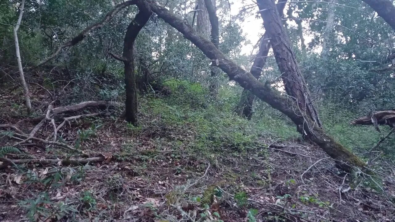
Checking out the Hill Shade "Route" off the Grizzly Flat Trail into the Canyon
The USGS Hill Shade map shows the old Stevens Canyon Road continuing beyond the location of where the 1897 historical topo map showed. Figuring out how to access that area is the topic of the next videos.
I had always seen what looked like an old road on the far side of the canyon when dropping down the stream crossing on the Grizzly Flat Trail. This road continues up past where I got to in this video. Three plans of attack are:
1. Climb over the downed trees that stopped me in the earlier video.
2. Climb down from the lower end of Grizzly Flat trail.
3. Then there's some old roads I've seen dropping down off higher up Grizzly Flat Trail that seem to be heading into the same canyon as this portion of the road is heading up.
It's hard to be certain of any of this as the old and new maps seem to be very inaccurate in this area. They show the Branch D canyon starting about 0.1 miles further upstream from this location. I think the modern maps make use of much of the topographic information on the older maps and thus if the old map was off, then new map is off as well.
I didn't find any signs of an old road dropping down from the Grizzly Flat trail, there may still be something farther down. It does appear there's a faint game trail here and a series of undulations in the slope to make it down the ridge. This is all part of learning to interpret the hill shade map layer.
USGS Hill Shade map layer:
https://apps.nationalmap.gov/viewer/
About the USGS HTMC:
https://www.usgs.gov/programs/national-geospatial-program/historical-topographic-maps-preserving-past
View/download maps on the TopoView site:
https://ngmdb.usgs.gov/topoview/
I used the 1895 Palo Alto quadrangle or the 1900 historical topo as listed in GaiaG:
https://www.gaiagps.com/
More to come...
Subscribe for more content like this
Comment, rate, share & click the bell icon
And as always, thanks for watching
#USGS #HillShade
-
 1:39:05
The Quartering
4 hours agoTrump's Epic Speech, Democrat & MSM Meltdown, Zelensky Flip Flops AGAIN & A T*ans CULT Unmasked
76.1K42 -
 1:28:13
Tucker Carlson
4 hours agoJonathan Roumie: The Weight of Playing Jesus in the Chosen, & Why You Should Observe Lent
83K48 -
 LIVE
LIVE
Film Threat
19 hours agoDAREDEVIL: BORN AGAIN ARRIVES! | Hollywood on the Rocks
132 watching -
 LIVE
LIVE
The HotSeat
1 hour agoIs The American Family Going Extinct??
857 watching -
 1:04:31
Ben Shapiro
4 hours agoEp. 2151 - Trump’s HOME RUN State of the Union!
73.1K46 -
 2:06:31
Right Side Broadcasting Network
4 hours agoLIVE REPLAY: White House Press Secretary Karoline Leavitt Holds Press Briefing - 3/5/25
103K62 -
 1:16:50
Simply Bitcoin
5 hours ago $4.41 earnedBLACKROCK'S GAME CHANGING BITCOIN REPORT Creates $900T of FOMO? | EP 1195
30K3 -
 1:00:23
The White House
4 hours agoPress Secretary Karoline Leavitt Briefs Members of the Media, Mar. 5, 2025
44.6K26 -
 23:34
23:34
marcushouse
15 hours ago $1.37 earnedWhat Really Happened to Starship? The Full Story! 🚀
23K5 -
 16:55
16:55
T-SPLY
9 hours agoMSNBC Used A Child Brain Cancer Survivor To Make Donald Trump Look Bad
25.4K42