Premium Only Content

Hiking San Bernardino Peak | 2022
June 4th, 2022
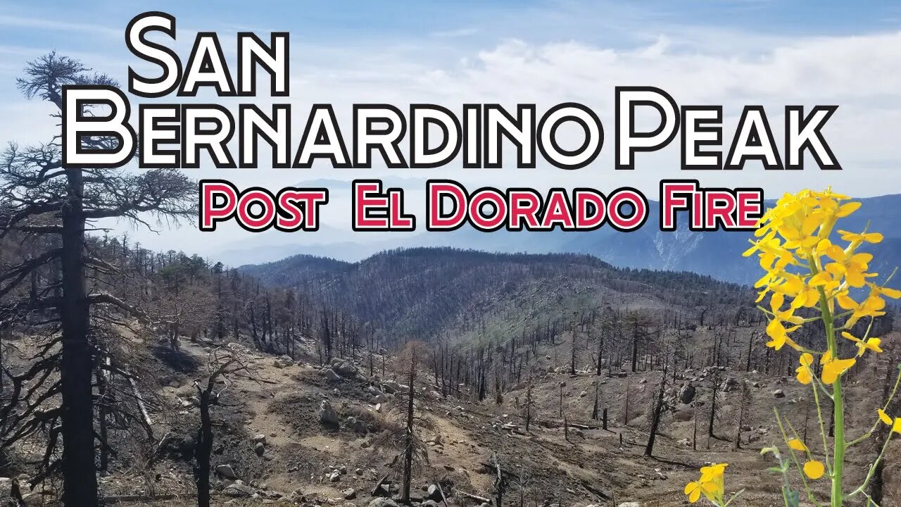
On September 5th, 2020, the El Dorado Fire was started by a pyrotechnic smoke device at a Gender Reveal Party near Yucaipa, California. By the time the fire was extinguish on November 16, 2020, the wildfire had burnt nearly 23,000 acres in the San Bernardino National Forest. Jake and I hike this mountain just over 2 months prior on June 27, 2020. The landscape was change in a way it will never be the same in my lifetime.
The trail was close for over a year which made it impossible for me to hike this peak for the 2021 SoCal Six Pack of Peaks Challenge. It was nice to finally get back to this great trail and hike to the top once again and also see the devastation for the first time. My nephew Matthew Tovey joined me for the hike which made for a fun adventure.
Another successful trip to the top of San Bernardino Peak for me and Jake’s first time to the top. It’s a long hike with considerable elevation gain which makes it tough. I pushed Jake very hard on this hike and he killed it. I’m very proud of him and I hope the prodding and poking from the beginning to the end of this trip helps him to appreciate how hard work and determination will make you successful in life. Ultimately, he made it to through this hike on his own strength (I never carried him), but a friend and partner make a huge difference. Having him with me, makes these trips so much more enjoyable.
Peak #4 of the original six of the Southern California Six Pack of Peaks Challenge.
Directions below to the trailhead pulled from the USDA Forrest Service website.
From Angelus Oaks, turn east off Highway 38 onto Manzanita. Then turn to the immediate left onto the frontage road that parallels Highway 38. Turn right onto FS road 1W07 and stay to the right up the dirt road 300 yards to the trailhead (5,960'). Columbine Camp (water usually available-8,000') is 4.7 miles from the trailhead just beyond Manzanita Flats. The camp is to the right (south) of the trail and .7 mile and 300 vertical feet below it. Two miles beyond Columbine Springs Junction is Limber Pine Bench Camp (9,200'). Water is obtained from a spring .3 mile beyond the camp. Two and two-tenths miles further beyond Limber Pine Camp located on the San Bernardino Peak Divide Trail is San Bernardino (10,624') and San Bernardino East Peaks. Another two miles east along the Peak Divide Trail is Trail Fork Springs (water available near trail junction-10,400'). The San Bernardino Peak Trail and the Divide Trail both offer outstanding views in all directions. The flatlands of the Inland Empire lay nearly 10,000 vertical feet below Limber Pine Camp and the trail above. This is a wilderness area within the Sand to Snow National Monument.
Did you know?
Southern California’s original Initial Point was established in 1852, by the surveyor Henry Washington. Washington intended to locate it atop the 10,649 foot San Bernardino Peak, but determined that the summit was not visible from the valley below, so he established the point half a mile west, 350 feet lower in elevation, but more visible from the west. He built a tower at the site, a 25-foot tall pole rising from a pile of rocks, with dangling tin reflectors, to make the point even more visible from below. The pile of rocks and the bottom part of the pole are still there, preserved primarily by the remoteness of the site.
https://www.fs.usda.gov/recarea/sbnf/recarea/?recid=26577
Music featured in this video:
Showers of Peace
American Legion
https://www.epidemicsound.com/track/KLsq89i8Q5/
In Other Words, You Know
Isola James
https://www.epidemicsound.com/track/owUa3p6sCR/
You may also follow me on Instagram at
https://www.instagram.com/eric_coleman_outdoors/
#sixpackofpeakschallenge #eldoradofire #hikecalifornia #hikesocal
-
 0:15
0:15
Coleman Outdoors
1 year agoBelow Mt Whitney at Guitar Lake 9/10/23 #backpacking #mtwhitney #jmt
25 -
 8:44
8:44
RTT: Guns & Gear
17 hours agoStreamlight TLR RM2 Laser - G | The Best PCC Light
1.06K -
 36:38
36:38
Athlete & Artist Show
1 month ago $0.03 earnedNCAA Hockey Was A Joke, TNT Hockey Panel Is The Best In Sports
1.95K1 -
 1:00:08
Trumpet Daily
20 hours ago $3.39 earnedBanning Mystery of the Ages - Trumpet Daily | Jan. 17, 2025
3.91K16 -
 15:10
15:10
Chris From The 740
1 day ago $0.10 earnedEAA Girsan Disruptor X 500-Round Review: Is It Reliable?
1.24K -
 1:00:38
PMG
14 hours agoCarnivore & Dr. Shawn Baker - Health Starts With Food
1.74K -
 1:28:13
Kim Iversen
15 hours agoCancelled Chef Pete Evans Exposes The One Change That Could End Big Food and Pharma
79K77 -
 4:20:21
Nerdrotic
17 hours ago $77.13 earnedDaradevil Born Again, Comics Industry CRASH, Neu-Hollywood REBUILD | Friday Night Tights #337
236K50 -
 1:32:34
Glenn Greenwald
13 hours agoThe Future of Gaza With Abubaker Abed; Journalist Sam Husseini On His Physical Expulsion From Blinken’s Briefing & Biden’s Gaza Legacy | System Update #391
120K92 -
 1:34:48
Roseanne Barr
15 hours ago $24.01 earnedWe are so F*cking Punk Rock! with Drea de Matteo | The Roseanne Barr Podcast #83
93.7K79