Premium Only Content
This video is only available to Rumble Premium subscribers. Subscribe to
enjoy exclusive content and ad-free viewing.

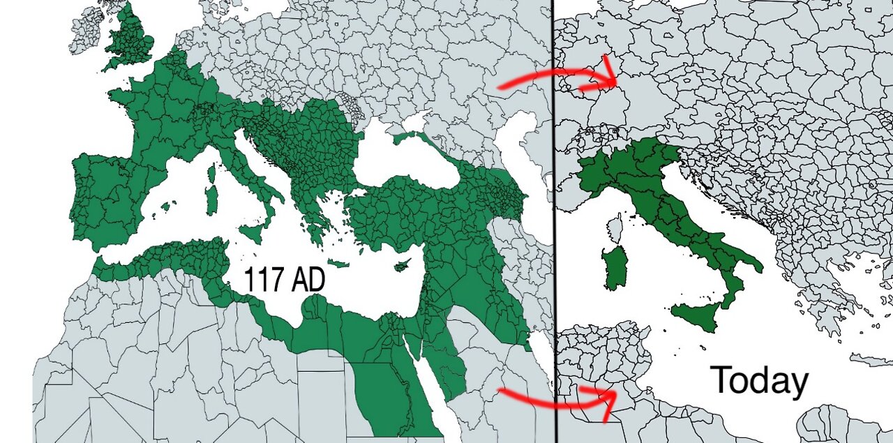
Countries: Then and Now (Part 1)
Repost
2 years ago
3
Countries
country
country comparison
country empire
Italy
Roman Empire
Japanese Empire
Russian Empire
Empire
Historic countries
modern countries
Maps of modern countries (or their predecessors) at their largest size compared to the current size of those same countries today.
The maps were made with MapChart.
https://mapchart.net/index.html
(I also used Autodesk Sketchbook to modify some of the subdivision borders to make the historic country maps look more accurate.)
Music: The Awakening by Patrick Patrikios
Loading comments...
-
 1:30:23
Twins Pod
14 hours agoHe Went From MARCHING With BLM To Shaking Hands With TRUMP! | Twins Pod - Episode 45 - Amir Odom
126K29 -
 1:02:30
Exploring With Nug
15 hours ago $3.38 earned2 Duck Hunters Missing After Kayak Capsizes!
54.6K2 -
 46:48
46:48
Mally_Mouse
9 hours agoLet's Hang!! -- Opening Christmas gifts from YOU!
65.2K1 -
 44:55
44:55
Athlete & Artist Show
20 days ago $2.04 earnedNHL 4 Nations Snubs, Was Hawk Tuah Coin A Scam?
63.7K -
 33:47
33:47
Stephen Gardner
14 hours ago🔥Pentagon Whistleblower UNLEASHES on Biden and Obama!
119K209 -
 2:20:30
The Dilley Show
16 hours ago $27.96 earnedRoger Stone in Studio plus Q&A Friday! w/Author Brenden Dilley 12/27/2024
97.9K21 -
 1:57:02
The Charlie Kirk Show
14 hours agoThe Great H-1B Battle + AMA | Lomez | 12.27.24
184K293 -
 11:39
11:39
Russell Brand
1 day agoWhat You're Not Being Told About The Syrian War
181K288 -
 DVR
DVR
Bannons War Room
1 year agoWarRoom Live
101M -
 1:49:21
Film Threat
17 hours agoBEST AND WORST OF 2024 + SQUID GAME SEASON 2 | Film Threat Livecast
64.6K6