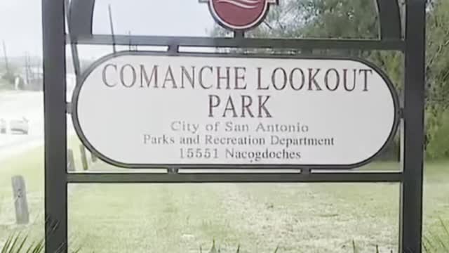
Comanche Lookout Park
You couldn’t ask for a more fitting landmark at Comanche Lookout Park than its old four-story limestone tower, which looks like the remnant of a medieval castle.
After all, the 96-acre park is home to one of the most majestic views in San Antonio, with a history just as sprawling.
“Just having that building there is so iconic, (along with) the fact that people knowing it was an Indian settlement,” said Sandy Jenkins, parks project manager for the Parks and Recreation Department. “And I think just every bit about the walking trails. And now there’s a great library and a playground. (There are) just really great things in that park.”
Located on the Northeast Side just inside Loop 1604, the park is home to Comanche Hill, the fourth-highest point in Bexar County, with an elevation of 1,340 feet. (The highest is Mount Smith at 1,892 feet in Northwest Bexar County.)
As a park site marker notes, Comanche Hill lies at the southeastern edge of the Edwards Plateau and makes up the western edge of the Blackland Prairie. Around 4½ miles of paved and natural trails wind and intertwine through countless live oak trees, along with cedar, mountain laurel and mesquite, with the occasional bench to take in the scenery.
According to Parks and Recreation, American Indians used the hill as a vantage point for warfare and hunting, with the Apache and later the Comanche Indians especially dominating the area, hence the name Comanche Lookout.
But the roots of this land run much deeper than its namesake.
Paul B. Barwick used to work with the department and put together a history of the site. He traced the area’s use back to 9200 B.C. when aboriginal hunters and gathers likely used the hill to scout for mammoth and bison watering along the nearby Cibolo Creek, and generation after generation of prehistoric man quarried the region’s abundance of flint to craft arrow points and tools.
According to Barwick, various fossils had been found along the creekbed banks, with artifacts such as undecorated ceramics and small arrow points discovered in the region along Cibolo Creek.
“I haven’t heard of any in recent times,” Jenkins said. “People do look.”
Another major marker of Comanche Lookout’s more distant past — its place on a historic trail used by Spanish explorers and missionaries more than 300 years ago.
Comanche Lookout lies near part of the El Camino Real de los Tejas National Historic Trail, the U.S. corridor of the Spanish colonial “royal road” that runs 2,580 miles across Texas from Mexico City to northwest Louisiana.
According to Barwick, the Spanish laid claim to this east-west artery of commerce in Texas in the late 1600s, lining the route with numerous missions, including the Alamo, to monitor French movement westward from what’s now Louisiana into the current Lone Star State.
The Comanche were the most notable of the American Indians to inhabit the area in and around the hill, Barwick noted, where they would “silently lie in wait for unsuspecting travelers, supply trains and soldiers, then quickly swoop down, stealing ammo, supplies, horses and mercilessly killing men, women and children.”
But by the mid-1800s, the hill became a lookout post against the Comanche. An 1848 deed showed the hill and its surrounding property belonged to Mirabeau Lamar, the second president of the Republic of Texas.
Comanche Lookout would later pass from Lamar’s daughter Loretta Caldwell to German immigrant farmer Gustav Reeh in the 1890s. Reeh sold the area that included Comanche Lookout to its most colorful owner, retired Army Colonel Edward R. Coppock.
A veteran of the Spanish-American War and World War I with more than 40 years of service, Coppock took over Comanche Lookout in 1923. The parks department describes him as a romantic and a history aficionado, whose time in Europe may well have inspired him to try transforming the hilltop into a courtly compound straight out of the Middle Ages — only also with an aesthetic twist that truly reflected his love of the land.
-
 45:20
45:20
Rethinking the Dollar
1 hour agoGolden Opportunity: Trump's Noise Has Been Great For Gold But....
4.1K4 -
 1:02:04
Ben Shapiro
3 hours agoEp. 2143 - The True Faces Of Evil
56.8K78 -
 1:26:19
Game On!
3 hours agoSports Betting Weekend Preview with Crick's Corner!
13.4K1 -
 30:45
30:45
CatfishedOnline
3 hours agoMan Plans To Marry His Military Girlfriend Or Romance Scam?
15K1 -
 1:58:32
The Charlie Kirk Show
4 hours agoHello Kash, Good-Bye Mitch + AMA | Morris | 2.21.2025
117K50 -
 59:48
59:48
The Dan Bongino Show
7 hours agoThe Golden Age Of Republican Politics (Ep. 2428) - 02/21/2025
788K1.54K -
 2:03:14
Tim Pool
6 hours agoThe RETURN Of Riot Season, Summer of Love 2.0 Is COMING | The Culture War Podcast
120K49 -
 1:01:26
Dr. Eric Berg
4 days agoThe Dr. Berg Show LIVE February 21, 2025
59.9K11 -
 54:47
54:47
Steven Crowder
6 hours agoSharpening Spiritual Tools, Handling Infidelity & Manifesting Destiny | Tough Love with Guru Crowder
166K311 -
 58:12
58:12
The Big Mig™
10 hours agoGlobal Finance Forum From Bullion To Borders We Cover It All
29.6K1