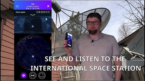
1 year agoHow to See The International Space Station | Satellite Tracker Android AppRobbie Strike Channel, Not Account
1 year agoAbout Burners, Satellite, KaiOS Phones, and Data only for Privacy + QARob Braxman TechVerified
1 year agoI Found This Ancient HillTop Ruin Using Satellite Imagery - 4 Wheeled and Hiked To It! #FullTourOff-Grid Backcountry Adventures
1 year agoSU: War Is Coming to American Soil! NKorea Launches Ballistic Capable Satellite Over Japan! + MORECarolBrown747
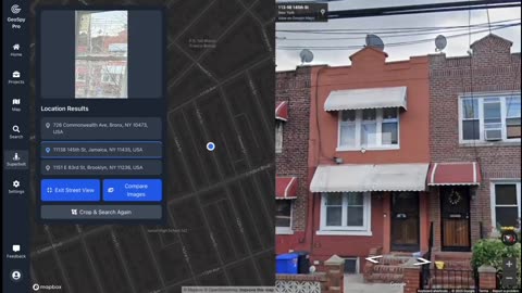
29 days agoOpen Source Intelligence (OSINT🌐) Finding the exact location with just a picture using GeoSpy.AIZoZo6zxl6z66
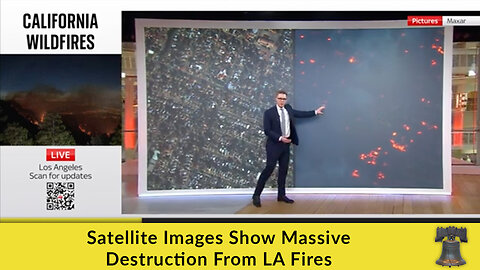
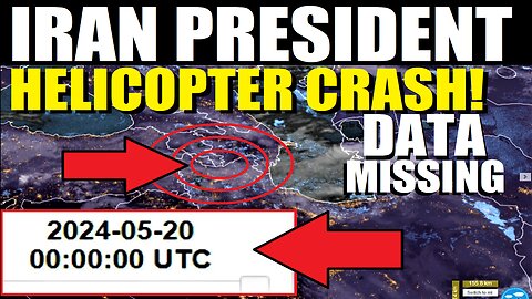
10 months agoBREAKING! Weather/Satellite Data MISSING for Iran President Helicopter Crash!In2thinairNews
1 year agoTucker Carlson Putin Interview Was INSANE 🤯 "Clinton Accepted Russia Into NATO But CIA Blocked It"johnnymassacre
1 year agoMaui destruction was a satellite DEW initiated by worldwide cabal. The fall of the cabal soon as people become aware of the plan.michaelj5326Verified
1 year agoAbout Burners, Satellite, KaiOS Phones, and Data only for Privacy + QARob Braxman TechVerified
1 year agoLas Vegas & Lake Mead 1972-2021 Satellite Timelapse NASA Imagery #lasvegas #lakemead #water #droughtMOJO ADVENTURES
6 months agoAHN News - How Land Fraud is Used to Steal Your Future and Freedom (Mark Finchem, Shawn Taylor, etc)America HappensVerified
17 days agoThe Chosen Heroes - Ep.19: Using a Gauss Meter/Shielding with Armando DelatoroThe Chosen HeroesVerified
1 year agoUS2020 Election Fraud: The Italy/Frankfurt Connection & Leonardo's Galilleo SatelliteTalkToTheBody