Geography
7 videos
Updated 11 months ago
Geography is the study of the lands, features, inhabitants, and phenomena of Earth. Geography is an all-encompassing discipline that seeks an understanding of Earth and its human and natural complexities—not merely where objects are, but also how they have changed and come to be
-
The 5 Biggest Earthquakes in History
 Earth Wind and FireThe Alaskan earthquake Also called Great Alaska Earthquake occurred on March 27, 1964 at 17:36 hours. Fortunately the quake of 9.2 Richter degrees occurred in the unpopulated state. This great earthquake and tsunami took the lives of 128 people (113 tsunami, earthquake 15). Earthquake in Sumatra, Indonesia The December 26, 2004 an earthquake measuring 9.1 on the Richter scale was recorded at 6:58 hours. The earthquake occurred when the tectonic plates of India and Burma made contact whose energy is said to be 23,000 times greater than that generated by the atomic bombing of Hiroshima. The balance of the earthquake and tsunami: 280 thousand victims. The worst earthquake in Japan's history The March 11, 2011, the Pacific plate moved west with respect to the North American plate, 130 kilometers east of the city of Sendai. The magnitude was 9 degrees on the Richter scale. The death toll was more than 20,000, more than 3000 missing and 6000 injured 25. 1952 Kamchatka earthquake The main quake occurred at 16:58 GMT (4:58 local time) on November 4, 1952. The magnitude of 9.0 Mw. A tsunami caused great destruction and loss of life around the Kamchatka Peninsula and the Kuril Islands. Hawaii was also hit, with estimated damages of up to $ 1 million, but no human casualties reported. The tsunami reached as far away as Alaska, Chile and New Zealand391 views
 -
What would happen if New York City was struck by a La Palma mega tsunami?
 Earth Wind and FireWhat would happen if New York City was struck by a La Palma mega tsunami? Computer simulation shows the effects of a 20 m wave arriving there from the Southeast.1.71K views 3 comments
 -
What would happen if a La Palma Mega Tsunami struck New England?
 Earth Wind and FireWhat would happen if a La Palma Mega Tsunami struck New England? Physics-based computer simulation of a 20 m tall mega tsunami approaching Cape Cod.381 views
 -
Yellowstone supervolcano eruption would be a countrywide disaster
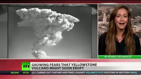
 Earth Wind and FireA paper in the “Geochemistry, Geophysics, Geosystems” journal lays out the suffering the US would undergo in a worst-case scenario disaster, predicting most major cities in the US being covered in layers of potentially deadly volcanic ash. 201421 views 1 comment
 -
1964 Quake: The Great Alaska Earthquake
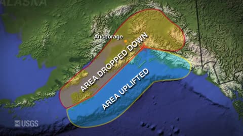
 Earth Wind and Fire"1964 Quake: The Great Alaska Earthquake" is an eleven minute video highlighting the impacts and effects of America's largest recorded earthquake. It is an expanded version of the four minute video "Magnitude 9.2". Both were created as part of USGS activities acknowledging the fifty year anniversary of the quake on March 27, 2014. The video features USGS geologist George Plafker, who, in the 1960's, correctly interpreted the quake as a subduction zone event. This was a great leap forward in resolving key mechanisms of the developing theory of plate tectonics. Landslide impacts and the extreme tsunami threat posed by these quakes are also discussed. Loss of life and destruction from the earthquake and accompanying tsunamis was the impetus for things like the NOAA Tsunami Warning Centers and the USGS Earthquake Hazards Program.181 views
 -
120 Years of Earthquakes and Their Tsunamis: 1901-2020
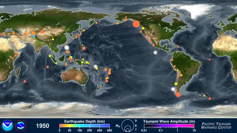
 Earth Wind and Fire120 Years of Earthquakes and Their Tsunamis: 1901-2020 This animation shows every recorded earthquake in sequence as they occurred from January 1, 1901, through December 31, 2020, at a rate of 1 year per second. More geography related videos here https://rumble.com/playlists/cYA64Dyo9DY217 views
 -
How Mountains Are Created - Geography Basics
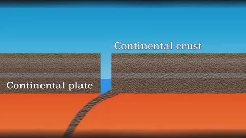
 F5TornadoHow Mountains Are Created - Geography Basics A mountain is an elevated portion of the Earth's crust, generally with steep sides that show significant exposed bedrock. Although definitions vary, a mountain may differ from a plateau in having a limited summit area, and is usually higher than a hill, typically rising at least 300 metres (980 ft) above the surrounding land. A few mountains are isolated summits, but most occur in mountain ranges. Mountains are formed through tectonic forces, erosion, or volcanism, which act on time scales of up to tens of millions of years. Once mountain building ceases, mountains are slowly leveled through the action of weathering, through slumping and other forms of mass wasting, as well as through erosion by rivers and glaciers. High elevations on mountains produce colder climates than at sea level at similar latitude. These colder climates strongly affect the ecosystems of mountains: different elevations have different plants and animals. Because of the less hospitable terrain and climate, mountains tend to be used less for agriculture and more for resource extraction, such as mining and logging, along with recreation, such as mountain climbing and skiing. The highest mountain on Earth is Mount Everest in the Himalayas of Asia, whose summit is 8,850 m (29,035 ft) above mean sea level. The highest known mountain on any planet in the Solar System is Olympus Mons on Mars at 21,171 m (69,459 ft). More geography related videos here https://rumble.com/playlists/cYA64Dyo9DY174 views


